Railway points and semaphore signals, Market Bosworth
Introduction
The photograph on this page of Railway points and semaphore signals, Market Bosworth by Jaggery as part of the Geograph project.
The Geograph project started in 2005 with the aim of publishing, organising and preserving representative images for every square kilometre of Great Britain, Ireland and the Isle of Man.

There are currently over 7.5m images from over 14,400 individuals and you can help contribute to the project by visiting https://www.geograph.org.uk
Railway points and semaphore signals, Market Bosworth
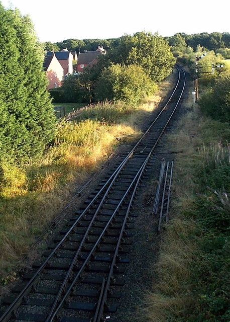
Image: © Jaggery Taken: 23 Aug 2014
Viewed from Station Road. The double track through Market Bosworth railway station becomes single track ahead. This is the Battlefield Line, the last remaining part of the former Ashby and Nuneaton Joint Railway which was opened in 1873. Operated by the Shackerstone Railway Society, it runs from Shackerstone via Market Bosworth to Shenton in Leicestershire.
Images are licensed for reuse under creativecommons.org/licenses/by-sa/2.0
Image Location
Latitude
52.625595
Longitude
-1.420856