Stebbing Village Hall
Introduction
The photograph on this page of Stebbing Village Hall by Robin Webster as part of the Geograph project.
The Geograph project started in 2005 with the aim of publishing, organising and preserving representative images for every square kilometre of Great Britain, Ireland and the Isle of Man.

There are currently over 7.5m images from over 14,400 individuals and you can help contribute to the project by visiting https://www.geograph.org.uk
Stebbing Village Hall
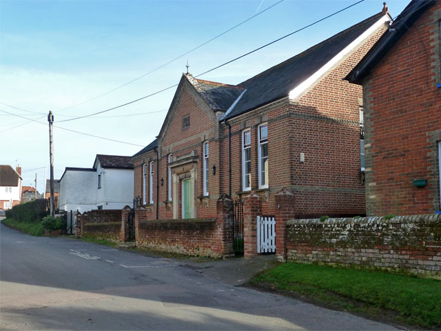
Image: © Robin Webster Taken: 11 Jan 2015
This is a grade II listed building built 1877, listed as 'United Reformed Church' but oddly not appearing on older maps as a church or chapel, although it does on more recent maps. It is directly opposite the unlisted but striking former Congregational Chapel, now flats. So was this building the hall for that chapel originally? It looks more like a hall than a chapel.
Images are licensed for reuse under creativecommons.org/licenses/by-sa/2.0
Image Location
Latitude
51.891694
Longitude
0.412371