Victoria Park Mount
Introduction
The photograph on this page of Victoria Park Mount by Christopher Hall as part of the Geograph project.
The Geograph project started in 2005 with the aim of publishing, organising and preserving representative images for every square kilometre of Great Britain, Ireland and the Isle of Man.

There are currently over 7.5m images from over 14,400 individuals and you can help contribute to the project by visiting https://www.geograph.org.uk
Victoria Park Mount
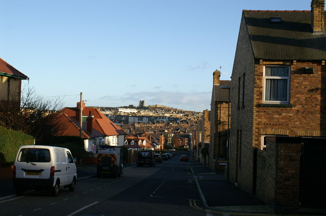
Image: © Christopher Hall Taken: 19 Dec 2014
This road has a distant view of Scarborough Castle. On the right streets of late 19th century terrace housing run off at right angles. 1These are known as 'The Avenues'. Less dense early 20th century semi-detached housing on the left.
Images are licensed for reuse under creativecommons.org/licenses/by-sa/2.0
Image Location
Latitude
54.28724
Longitude
-0.411714