Footpath from Cow Farm Lane to the Ongar Road
Introduction
The photograph on this page of Footpath from Cow Farm Lane to the Ongar Road by Hugh Gorton as part of the Geograph project.
The Geograph project started in 2005 with the aim of publishing, organising and preserving representative images for every square kilometre of Great Britain, Ireland and the Isle of Man.

There are currently over 7.5m images from over 14,400 individuals and you can help contribute to the project by visiting https://www.geograph.org.uk
Footpath from Cow Farm Lane to the Ongar Road
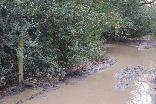
Image: © Hugh Gorton Taken: 6 Jan 2015
This is about 20m down the 'path' from the lane. The path has been completely wrecked by 4x4 drivers who have created huge ruts and depressions which are currently flooded. At least they haven't demolished the Public Footpath sign yet.
Images are licensed for reuse under creativecommons.org/licenses/by-sa/2.0
Image Location
Latitude
51.658493
Longitude
0.273446