Main Street, Oxton, Notts.
Introduction
The photograph on this page of Main Street, Oxton, Notts. by David Hallam-Jones as part of the Geograph project.
The Geograph project started in 2005 with the aim of publishing, organising and preserving representative images for every square kilometre of Great Britain, Ireland and the Isle of Man.

There are currently over 7.5m images from over 14,400 individuals and you can help contribute to the project by visiting https://www.geograph.org.uk
Main Street, Oxton, Notts.
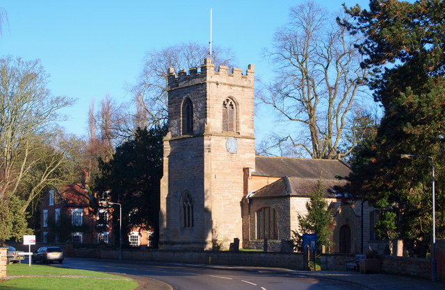
Image: © David Hallam-Jones Taken: 4 Jan 2015
The Grade I-listed Parish Church of St Peter & St Paul is seen here from Manor Close. It is generally thought that a church existed at Oxton at the time of the Domesday survey although it has been suggested that it would probably have been smaller and probably aisle-less. As an adult, the son of the Rev. William Mompesson of Eyam Plague fame became a prebendary of Oxton and Crophill. As an infant his son was evacuated to Sheffield in 1666, prior to the plague taking hold of that village. This occurred before the quarantine was agreed, after which time all the Eyam villagers were pressured into staying put.
Images are licensed for reuse under creativecommons.org/licenses/by-sa/2.0
Image Location
Latitude
53.055971
Longitude
-1.061648