Vanished Railway Station
Introduction
The photograph on this page of Vanished Railway Station by Robert Struthers as part of the Geograph project.
The Geograph project started in 2005 with the aim of publishing, organising and preserving representative images for every square kilometre of Great Britain, Ireland and the Isle of Man.

There are currently over 7.5m images from over 14,400 individuals and you can help contribute to the project by visiting https://www.geograph.org.uk
Vanished Railway Station
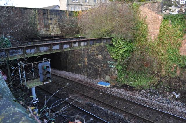
Image: © Robert Struthers Taken: 30 Dec 2014
The Fife Circle railway line passes under St Clair Street here. Sinclairtown Station was on this site between 1847 and c.1968 - the steel beams supported the booking hall and stairs descended to platform level. The closed-up doors and windows can be seen in the remaining stone wall - see Image for a view from St Clair Street.
Images are licensed for reuse under creativecommons.org/licenses/by-sa/2.0
Image Location
Latitude
56.123911
Longitude
-3.141714