Apedale Country Park: track north from Apedale Road
Introduction
The photograph on this page of Apedale Country Park: track north from Apedale Road by Jonathan Hutchins as part of the Geograph project.
The Geograph project started in 2005 with the aim of publishing, organising and preserving representative images for every square kilometre of Great Britain, Ireland and the Isle of Man.

There are currently over 7.5m images from over 14,400 individuals and you can help contribute to the project by visiting https://www.geograph.org.uk
Apedale Country Park: track north from Apedale Road
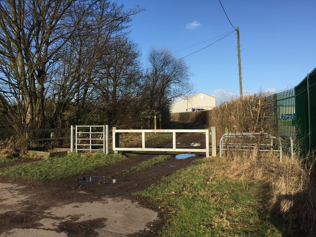
Image: © Jonathan Hutchins Taken: 2 Jan 2015
Four different barriers/enablers to access, horses on extreme left, humans on extreme right. Beyond the barriers a sign (largely in shadow behind the signpost) proclaims 'Staffordshire County Council - Apedale Community Country Park.' The word 'Community' has since been silently dropped from the name of this and Silverdale Community Country Park. The track is the former route of a mineral railway serving an adjacent chemical works and Burley Pit (Apedale Colliery).
Images are licensed for reuse under creativecommons.org/licenses/by-sa/2.0
Image Location


Leaflet Map data © OpenStreetMap
Latitude
53.037168
Longitude
-2.266011