Hockwold cum Wilton St Peter's church
Introduction
The photograph on this page of Hockwold cum Wilton St Peter's church by Adrian S Pye as part of the Geograph project.
The Geograph project started in 2005 with the aim of publishing, organising and preserving representative images for every square kilometre of Great Britain, Ireland and the Isle of Man.

There are currently over 7.5m images from over 14,400 individuals and you can help contribute to the project by visiting https://www.geograph.org.uk
Hockwold cum Wilton St Peter's church
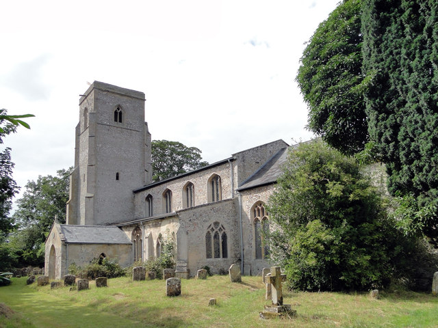
Image: © Adrian S Pye Taken: 5 Aug 2010
Now maintained by the Churches Conservation Trust it is usually only open at weekends, but the key is not far away. The church is redundant and part of the parish of Hockwold-cum-Wilton. The 14th c. south-west sited tower has a plain parapet; notice how the buttresses change to diagonal half way up. Over the nave is a four window clerestory, necessitated by the small windows of the south aisle, on the north side the windows are much taller. Inside is a very plain 14th c. octagonal font. Which is coeval with the arcades and building of the church. The roof is 15th c with arch-braced tie-beams and hammerbeams alternating along its length, as at Methwold. In the chancel is a 14th c. piscina and sedilia group with foliated cusps to the ogee arches. I believe the reredos is Victorian work. Between them is a large wall monument to John Hungerford (1719).
Images are licensed for reuse under creativecommons.org/licenses/by-sa/2.0
Image Location
Latitude
52.462827
Longitude
0.537424