Science Park and golf course
Introduction
The photograph on this page of Science Park and golf course by M J Richardson as part of the Geograph project.
The Geograph project started in 2005 with the aim of publishing, organising and preserving representative images for every square kilometre of Great Britain, Ireland and the Isle of Man.

There are currently over 7.5m images from over 14,400 individuals and you can help contribute to the project by visiting https://www.geograph.org.uk
Science Park and golf course
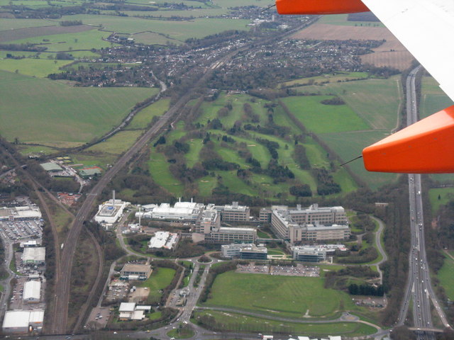
Image: © M J Richardson Taken: 12 Dec 2014
Plenty of things here - the A1[M] motorway and East Coast Mainline railway heading south, the Knebworth Golf Club course, a 'Research Centre' [not sure what is there], a branch line going off left to, I assume, Hertford, farmland, and the village of Knebworth at the top.
Images are licensed for reuse under creativecommons.org/licenses/by-sa/2.0
Image Location
Latitude
51.883579
Longitude
-0.199083