OS benchmark - Church Stretton school
Introduction
The photograph on this page of OS benchmark - Church Stretton school by Richard Law as part of the Geograph project.
The Geograph project started in 2005 with the aim of publishing, organising and preserving representative images for every square kilometre of Great Britain, Ireland and the Isle of Man.

There are currently over 7.5m images from over 14,400 individuals and you can help contribute to the project by visiting https://www.geograph.org.uk
OS benchmark - Church Stretton school
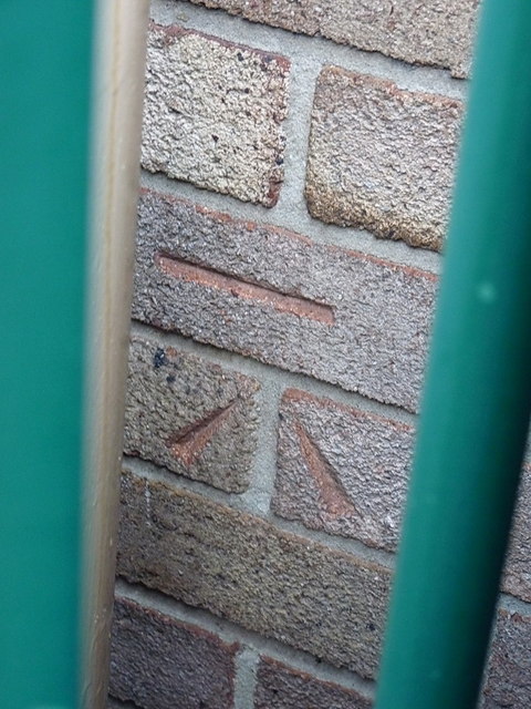
Image: © Richard Law Taken: 13 Dec 2014
An OS cutmark on the wall of the former school coke house; originally levelled at 189.653m above Ordnance Datum Newlyn. A clear & level photo is hard to come by, as the mark lies on the wrong side of a high fence, through which this picture is taken.
Images are licensed for reuse under creativecommons.org/licenses/by-sa/2.0
Image Location
Latitude
52.544539
Longitude
-2.805181