River Slea, Sleaford, Lincs.
Introduction
The photograph on this page of River Slea, Sleaford, Lincs. by David Hallam-Jones as part of the Geograph project.
The Geograph project started in 2005 with the aim of publishing, organising and preserving representative images for every square kilometre of Great Britain, Ireland and the Isle of Man.

There are currently over 7.5m images from over 14,400 individuals and you can help contribute to the project by visiting https://www.geograph.org.uk
River Slea, Sleaford, Lincs.
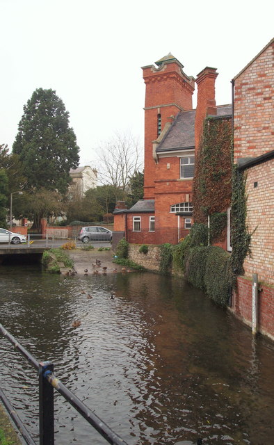
Image: © David Hallam-Jones Taken: 29 Nov 2014
Water Gate ahead, from the Riverside Shopping Centre. The former fire station dominates the point where Water Gate becomes West Banks (another road name). A water mill previously stood where this building now stands. The complex now houses offices but date stones on the site bear the dates of the construction of the original fire station building, i.e. 1829 and this building, 1900. The driveway entrance to the Riversdale Health Clinic is situated beyond the old fire station.
Images are licensed for reuse under creativecommons.org/licenses/by-sa/2.0
Image Location
Latitude
52.998726
Longitude
-0.411718