North Gate (Galley Hill), Sleaford, Lincs.
Introduction
The photograph on this page of North Gate (Galley Hill), Sleaford, Lincs. by David Hallam-Jones as part of the Geograph project.
The Geograph project started in 2005 with the aim of publishing, organising and preserving representative images for every square kilometre of Great Britain, Ireland and the Isle of Man.

There are currently over 7.5m images from over 14,400 individuals and you can help contribute to the project by visiting https://www.geograph.org.uk
North Gate (Galley Hill), Sleaford, Lincs.
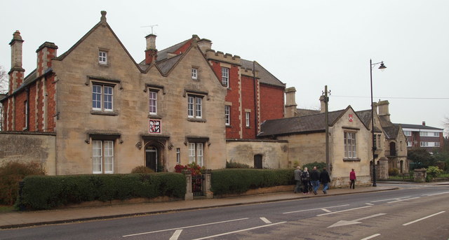
Image: © David Hallam-Jones Taken: 29 Nov 2014
A view along the east side of North Gate. This is a section of North Gate - i.e. the B1518 - furthest from the town centre. The street lamp marks its junction with Church Lane, in which the town's Fire Station is situated. Beyond the lamp and facing this 'main' road are the Northgate Almshouses. The buildings on the left form part of the Grade II-listed Carre's Grammar School. As a result of the gradual development of the school site over several hundred years a number of buildings in differing architectural styles can be seen fronting different sections of North Gate. The school was founded in 1604 as the result of a bequest by Robert Carre, of Aswarby, to provide for the education of local boys. It seems that the school went into a period of decline, effectively closing in 1816. However, a group of trustees purchased land in 1826 and secured funding in 1830 for the construction of new buildings and it reopened in 1835. Further extensions were added in the 1900s and these were added to in the 1940s and 1950s. The school became grant-maintained in 1991. It received Specialist Sports College status in 2003, Science specialist status in 2009 and it became an Academy in 2011.
Images are licensed for reuse under creativecommons.org/licenses/by-sa/2.0
Image Location
Latitude
53.002043
Longitude
-0.411