North Gate/Church Lane, Sleaford, Lincs.
Introduction
The photograph on this page of North Gate/Church Lane, Sleaford, Lincs. by David Hallam-Jones as part of the Geograph project.
The Geograph project started in 2005 with the aim of publishing, organising and preserving representative images for every square kilometre of Great Britain, Ireland and the Isle of Man.

There are currently over 7.5m images from over 14,400 individuals and you can help contribute to the project by visiting https://www.geograph.org.uk
North Gate/Church Lane, Sleaford, Lincs.
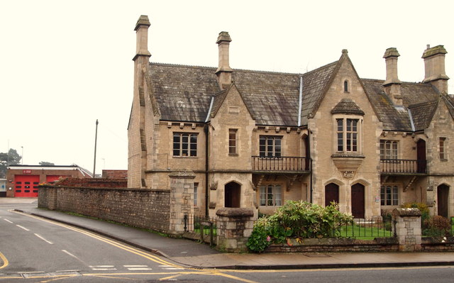
Image: © David Hallam-Jones Taken: 29 Nov 2014
Sleaford's "Community Fire Station" on Church Lane can be seen here near the north-east corner of the site occupied by the Northgate Almshouses. This almshouse building was constructed in 1857 as an addition to the Carre’s Hospital Almshouses in Eastgate. Church Lane passes the front of the fire station and forms a 'c' shaped arc around the back of the almshouses before it rejoins North Gate half a mile further on towards the town centre. The principal road at this junction is the B1518.
Images are licensed for reuse under creativecommons.org/licenses/by-sa/2.0
Image Location
Latitude
53.001769
Longitude
-0.410712