St. Paul's Place, Halliwell
Introduction
The photograph on this page of St. Paul's Place, Halliwell by philandju as part of the Geograph project.
The Geograph project started in 2005 with the aim of publishing, organising and preserving representative images for every square kilometre of Great Britain, Ireland and the Isle of Man.

There are currently over 7.5m images from over 14,400 individuals and you can help contribute to the project by visiting https://www.geograph.org.uk
St. Paul's Place, Halliwell
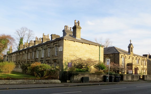
Image: © philandju Taken: 2 Dec 2014
St. Paul's Place in Halliwell consists of two terraces of stone cottages, one on each side of St. Paul's Church. This is the eastern terrace. The building to the right is now St. Paul's Community Centre. Built in 1847, it was originally a school.
Images are licensed for reuse under creativecommons.org/licenses/by-sa/2.0
Image Location
Latitude
53.595366
Longitude
-2.447342