Bishopton and Dumbarton from the air
Introduction
The photograph on this page of Bishopton and Dumbarton from the air by Thomas Nugent as part of the Geograph project.
The Geograph project started in 2005 with the aim of publishing, organising and preserving representative images for every square kilometre of Great Britain, Ireland and the Isle of Man.

There are currently over 7.5m images from over 14,400 individuals and you can help contribute to the project by visiting https://www.geograph.org.uk
Bishopton and Dumbarton from the air
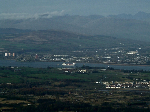
Image: © Thomas Nugent Taken: 24 Nov 2014
Part of the former ROF site is in the foreground, with some of the new houses at the west end of the site and the new access road from the A8 visible on the right. Two ships can be seen passing in the River Clyde near Dumbarton Rock, with the Vale of Leven beyond.
Images are licensed for reuse under creativecommons.org/licenses/by-sa/2.0
Image Location
Latitude
55.901768
Longitude
-4.520757