The Portobello (3) - sign, 139 Bransford Road, St. John's, Worcester
Introduction
The photograph on this page of The Portobello (3) - sign, 139 Bransford Road, St. John's, Worcester by P L Chadwick as part of the Geograph project.
The Geograph project started in 2005 with the aim of publishing, organising and preserving representative images for every square kilometre of Great Britain, Ireland and the Isle of Man.

There are currently over 7.5m images from over 14,400 individuals and you can help contribute to the project by visiting https://www.geograph.org.uk
The Portobello (3) - sign, 139 Bransford Road, St. John's, Worcester
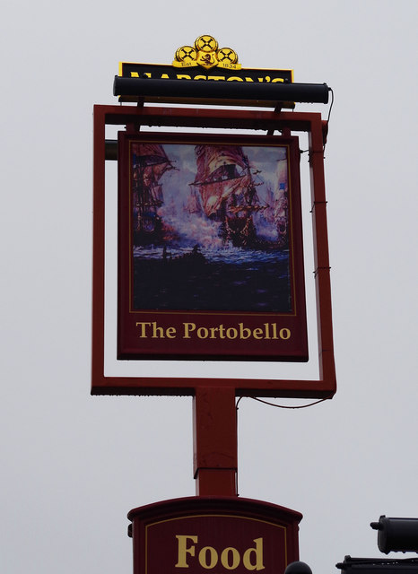
Image: © P L Chadwick Taken: 26 Nov 2014
The sign shows a sailing ship. The name originates from Vice Admiral Edward Vernon's capture of the Spanish controlled town of Puerto Bello (now known as Portobelo) in Panama in 1739. This proved a very popular achievement with the British public of the time. Image Image
Images are licensed for reuse under creativecommons.org/licenses/by-sa/2.0
Image Location
Latitude
52.184802
Longitude
-2.244947