Holywell Street, Chesterfield, Derbys.
Introduction
The photograph on this page of Holywell Street, Chesterfield, Derbys. by David Hallam-Jones as part of the Geograph project.
The Geograph project started in 2005 with the aim of publishing, organising and preserving representative images for every square kilometre of Great Britain, Ireland and the Isle of Man.

There are currently over 7.5m images from over 14,400 individuals and you can help contribute to the project by visiting https://www.geograph.org.uk
Holywell Street, Chesterfield, Derbys.
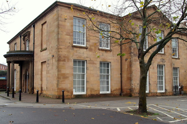
Image: © David Hallam-Jones Taken: 22 Nov 2014
The main facades of Holywell House face south-east and north-east onto a large car parking area. Holywell Street is just visible behind the railings beyond the porch. This Grade II-listed early C19th building is currently an annexe belonging to Holywell Healthcare, a GP medical practice with other local surgeries. It was reopened by the Duchess of Devonshire in 1993 following renovations. As it is adjacent to the former Royal Hospital site it may have been an annexe to that in the past?
Images are licensed for reuse under creativecommons.org/licenses/by-sa/2.0
Image Location
Latitude
53.238789
Longitude
-1.426551