Ancaster Hall
Introduction
The photograph on this page of Ancaster Hall by Alan Murray-Rust as part of the Geograph project.
The Geograph project started in 2005 with the aim of publishing, organising and preserving representative images for every square kilometre of Great Britain, Ireland and the Isle of Man.

There are currently over 7.5m images from over 14,400 individuals and you can help contribute to the project by visiting https://www.geograph.org.uk
Ancaster Hall
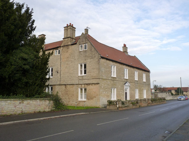
Image: © Alan Murray-Rust Taken: 19 Nov 2014
17th century house, later extended and altered, although these two fronts date from the original build date. Listed Grade II*. The wall in front of the house is 18th century, and the English Heritage listing describes it as 'evidently intended to lend dignity to the facade.'
Images are licensed for reuse under creativecommons.org/licenses/by-sa/2.0
Image Location
Latitude
52.980652
Longitude
-0.5375