Platforms of the disused Lea Bridge station
Introduction
The photograph on this page of Platforms of the disused Lea Bridge station by Marathon as part of the Geograph project.
The Geograph project started in 2005 with the aim of publishing, organising and preserving representative images for every square kilometre of Great Britain, Ireland and the Isle of Man.

There are currently over 7.5m images from over 14,400 individuals and you can help contribute to the project by visiting https://www.geograph.org.uk
Platforms of the disused Lea Bridge station
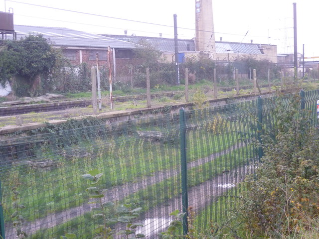
Image: © Marathon Taken: 19 Nov 2014
Lea Bridge station was opened on 15th September 1840 by the Northern & Eastern Railway as Lea Bridge Road and is thought to be the earliest example of a station having its building on a railway bridge, with staircases down to the platforms. The station buildings were demolished in the 1970s and the station itself closed on 8th July 1985. Closure was not the end of the story though as in December 2005, a new service between Stratford and Stansted Airport reintroduced regular passenger trains through the closed station and within the next year or so a new station will be opened here. The new station though will be on the south side of Lea Bridge Road, rather than the north side where the old station was located. There is so much information on the historic old Lea Bridge station that it is best to just show links to the many sites with photographs and its history. See http://en.wikipedia.org/wiki/Lea_Bridge_railway_station and http://www.abandonedstations.org.uk/North_Woolwich_line_1.html and http://www.londonreconnections.com/2013/lea-bridge-lives-again/ and http://www.disused-stations.org.uk/l/lea_bridge/
Images are licensed for reuse under creativecommons.org/licenses/by-sa/2.0
Image Location
Latitude
51.566431
Longitude
-0.036764