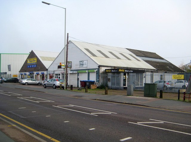
Welwyn Garden City: Pre-war industrial units on Broadwater Road
Introduction
The photograph on this page of Welwyn Garden City: Pre-war industrial units on Broadwater Road by Nigel Cox as part of the Geograph project.
The Geograph project started in 2005 with the aim of publishing, organising and preserving representative images for every square kilometre of Great Britain, Ireland and the Isle of Man.
There are currently over 7.5m images from over 14,400 individuals and you can help contribute to the project by visiting https://www.geograph.org.uk

Image: © Nigel Cox Taken: 15 Nov 2014
Old Ordnance Survey maps currently available online show that there were two blocks of four of these parallel pitched roof industrial units facing onto Broadwater Road before the outbreak of the Second World War, and these two survivors therefore represent part of Welwyn Garden City's industrial heritage. Significantly virtually all the later large factories on the opposite side of the road, including the Shredded Wheat and Roche buildings, are currently disused or have been demolished. These two are currently in use as retail outlets, Topps Tiles occupying the far one.
Image Location


