Bellsmyre High Flats: demolition in progress
Introduction
The photograph on this page of Bellsmyre High Flats: demolition in progress by Lairich Rig as part of the Geograph project.
The Geograph project started in 2005 with the aim of publishing, organising and preserving representative images for every square kilometre of Great Britain, Ireland and the Isle of Man.

There are currently over 7.5m images from over 14,400 individuals and you can help contribute to the project by visiting https://www.geograph.org.uk
Bellsmyre High Flats: demolition in progress
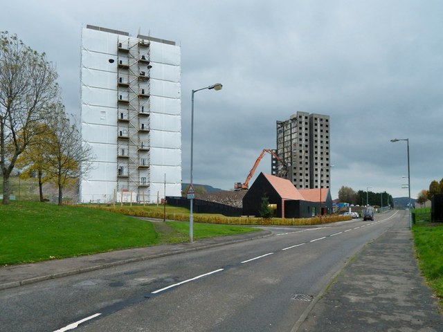
Image: © Lairich Rig Taken: 31 Oct 2014
For a corresponding picture taken almost a year earlier, when the buildings were all intact, see Image In both views, the nearest building is Kinglass House. In the present photograph, Endrick House is being dismantled, and Fruin House is already gone (compare the earlier view). The low building by the roadside is the recently-built Cutty Sark Community Centre, which occupies the same site as its predecessor, Howatshaws Hall.
Images are licensed for reuse under creativecommons.org/licenses/by-sa/2.0
Image Location
Latitude
55.959013
Longitude
-4.551717