Keston Windmill, BR2
Introduction
The photograph on this page of Keston Windmill, BR2 by Philip Talmage as part of the Geograph project.
The Geograph project started in 2005 with the aim of publishing, organising and preserving representative images for every square kilometre of Great Britain, Ireland and the Isle of Man.

There are currently over 7.5m images from over 14,400 individuals and you can help contribute to the project by visiting https://www.geograph.org.uk
Keston Windmill, BR2
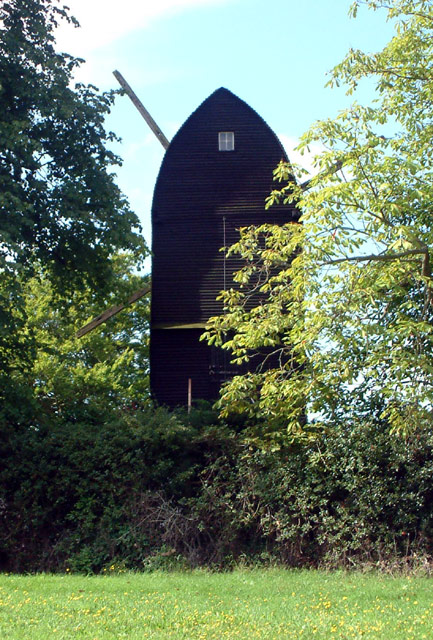
Image: © Philip Talmage Taken: 23 Aug 2005
Keston windmill was built in 1716 and still stands on the edge of Keston Common overlooking the vale of Keston. The mill is a 3-story black weatherboard wooden structure resting on a round brick base and built on high ground, over 450 feet above sea level. It is a 'post mill' type, with the structure tied to a central massive wooden post that allowed it to be turned as the direction of the wind changed.
Images are licensed for reuse under creativecommons.org/licenses/by-sa/2.0
Image Location


Leaflet Map data © OpenStreetMap
Latitude
51.36195
Longitude
0.031043