From England to Wales across the Wye from the M48 west of Beachley
Introduction
The photograph on this page of From England to Wales across the Wye from the M48 west of Beachley by Jaggery as part of the Geograph project.
The Geograph project started in 2005 with the aim of publishing, organising and preserving representative images for every square kilometre of Great Britain, Ireland and the Isle of Man.

There are currently over 7.5m images from over 14,400 individuals and you can help contribute to the project by visiting https://www.geograph.org.uk
From England to Wales across the Wye from the M48 west of Beachley
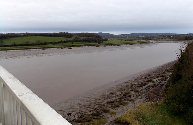
Image: © Jaggery Taken: 15 Dec 2013
Viewed from Wye Bridge. The Wye is near its mouth at the confluence with the River Severn. The river is about 270 metres wide under the bridge. The width of water varies with the tide. The midpoint on the river here marks the border between England (on this side) and Wales.
Images are licensed for reuse under creativecommons.org/licenses/by-sa/2.0
Image Location
Latitude
51.622274
Longitude
-2.657918