Church of St Paul, Cheltenham
Introduction
The photograph on this page of Church of St Paul, Cheltenham by Derek Harper as part of the Geograph project.
The Geograph project started in 2005 with the aim of publishing, organising and preserving representative images for every square kilometre of Great Britain, Ireland and the Isle of Man.

There are currently over 7.5m images from over 14,400 individuals and you can help contribute to the project by visiting https://www.geograph.org.uk
Church of St Paul, Cheltenham
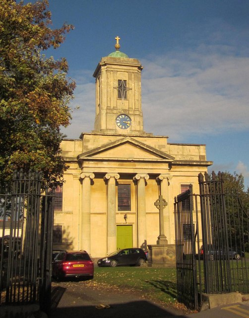
Image: © Derek Harper Taken: 25 Oct 2014
"Built in a Greek Revival style, with details based on the Temple at Ilissus", Athens http://list.english-heritage.org.uk/resultsingle.aspx?uid=1387184&searchtype=mapsearch . "Constructed of pinkish-brown brick in English Garden Wall Bond, with ashlar facing to the west (actually south) front". This is indeed the south front, glowing in winter afternoon sun, and also shown in Image The church, seen here from across St Paul's Road, is listed grade II*. In front of it is a war memorial, also listed http://list.english-heritage.org.uk/resultsingle.aspx?uid=1419400&searchtype=mapsearch , as are the foreground railings and gates, contemporaneous with the church http://list.english-heritage.org.uk/resultsingle.aspx?uid=1387884&searchtype=mapsearch .
Images are licensed for reuse under creativecommons.org/licenses/by-sa/2.0
Image Location
Latitude
51.906862
Longitude
-2.077285