Brockhampton Park
Introduction
The photograph on this page of Brockhampton Park by Derek Harper as part of the Geograph project.
The Geograph project started in 2005 with the aim of publishing, organising and preserving representative images for every square kilometre of Great Britain, Ireland and the Isle of Man.

There are currently over 7.5m images from over 14,400 individuals and you can help contribute to the project by visiting https://www.geograph.org.uk
Brockhampton Park
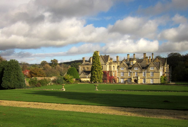
Image: © Derek Harper Taken: 25 Oct 2014
"A large Victorian house around the nucleus of a 17th century manor" http://www.sevenhampton.org/conservationareas.html ; now converted into 22 flats. See also Image and Image, and listed building description at http://list.english-heritage.org.uk/resultsingle.aspx?uid=1303429&searchtype=mapsearch .
Images are licensed for reuse under creativecommons.org/licenses/by-sa/2.0
Image Location


Leaflet Map data © OpenStreetMap
Latitude
51.901034
Longitude
-1.953444