Leyton Orient Football Club
Introduction
The photograph on this page of Leyton Orient Football Club by Nigel Cox as part of the Geograph project.
The Geograph project started in 2005 with the aim of publishing, organising and preserving representative images for every square kilometre of Great Britain, Ireland and the Isle of Man.

There are currently over 7.5m images from over 14,400 individuals and you can help contribute to the project by visiting https://www.geograph.org.uk
Leyton Orient Football Club
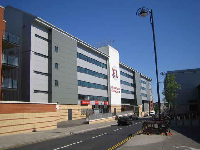
Image: © Nigel Cox Taken: 2 May 2007
Barry Hearn's millions have transformed Brisbane Road since he took over the club in 1995, but after a close tangle with relegation to the fourth tier of English League football in the 2006/7 season, playing fortunes seem no better. This is the new west stand in Oliver Road. Brisbane Road is the parallel road to the east. In the meantime, owing to the intransigence of the Liberal Democrat run Lewes District Council in challenging John Prescott's decision to allow a new Community Stadium to be built for the benefit of all of Sussex at Falmer, and more than 10 years after the club were forced to leave their home of 95 years, the Goldstone, fellow League members Brighton & Hove Albion continue to play at this godforsaken hovel Image
Images are licensed for reuse under creativecommons.org/licenses/by-sa/2.0
Image Location
Latitude
51.559655
Longitude
-0.01354