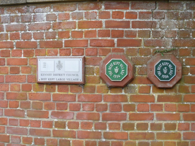
Seend features [9]
Introduction
The photograph on this page of Seend features [9] by Michael Dibb as part of the Geograph project.
The Geograph project started in 2005 with the aim of publishing, organising and preserving representative images for every square kilometre of Great Britain, Ireland and the Isle of Man.
There are currently over 7.5m images from over 14,400 individuals and you can help contribute to the project by visiting https://www.geograph.org.uk

Image: © Michael Dibb Taken: 26 Oct 2014
Seend has won the 'Best Kept Village' award a number of times. Seend is a hilltop village about 3¾ miles west of Devizes and some 5¾ miles northeast of Trowbridge. The name is from the Old English word ‘sende’ meaning a sandy place. It lies astride the A361 road from Devizes to Trowbridge, which was once the main road from London to Bath. The village has medieval origins, but there is evidence of occupation in Neolithic times. Farming, especially of wool, and later iron ore brought prosperity to Seend, which today is essentially a commuter village.

