St Giles Church, Ollerton, Notts
Introduction
The photograph on this page of St Giles Church, Ollerton, Notts by David Hallam-Jones as part of the Geograph project.
The Geograph project started in 2005 with the aim of publishing, organising and preserving representative images for every square kilometre of Great Britain, Ireland and the Isle of Man.

There are currently over 7.5m images from over 14,400 individuals and you can help contribute to the project by visiting https://www.geograph.org.uk
St Giles Church, Ollerton, Notts
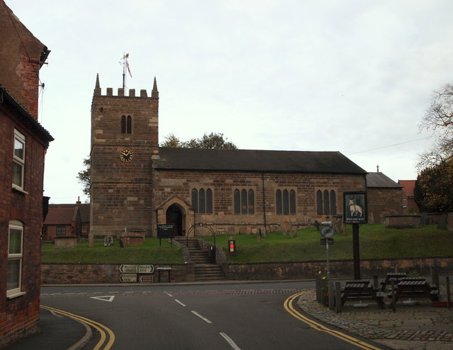
Image: © David Hallam-Jones Taken: 29 Oct 2014
This Grade II-listed church, dating from c.1790, is seen here from Station Road. The outside tables in the picture belong to The White Hart pub, a former meeting place for forestry officials from the Dukeries and supervisory staff from the hop fields. The latter were once to be found at the side of the River Maun (1790-1892). Previously Ollerton was at the crossroads of some well established routes between Newark-Worksop and Mansfield-Lincoln and it is said that this public house became a rendezvous venue for such male supervisors. Wellow Road is seen ahead.
Images are licensed for reuse under creativecommons.org/licenses/by-sa/2.0
Image Location
Latitude
53.198951
Longitude
-1.023051