Aerial View of Shotover House
Introduction
The photograph on this page of Aerial View of Shotover House by Dave Price as part of the Geograph project.
The Geograph project started in 2005 with the aim of publishing, organising and preserving representative images for every square kilometre of Great Britain, Ireland and the Isle of Man.

There are currently over 7.5m images from over 14,400 individuals and you can help contribute to the project by visiting https://www.geograph.org.uk
Aerial View of Shotover House
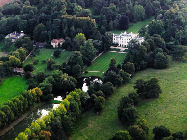
Image: © Dave Price Taken: 2 Sep 2014
Taken from paramotor. "Shotover House and garden were begun in about 1714 for James Tyrrell of Oakley. Tyrell died in 1718 and the house was completed by his son, General James Tyrell. There is no known record of the name of the architect. In 1855 the architect Joshua Sims added two wings in the same style of the original part of the house." (see http://en.wikipedia.org/wiki/Shotover#Shotover_House) The Obelisk can just be seen behind the main house.
Images are licensed for reuse under creativecommons.org/licenses/by-sa/2.0
Image Location
Latitude
51.755952
Longitude
-1.155182