A Bakerloo line train passes under the West Coast Main Line
Introduction
The photograph on this page of A Bakerloo line train passes under the West Coast Main Line by Marathon as part of the Geograph project.
The Geograph project started in 2005 with the aim of publishing, organising and preserving representative images for every square kilometre of Great Britain, Ireland and the Isle of Man.

There are currently over 7.5m images from over 14,400 individuals and you can help contribute to the project by visiting https://www.geograph.org.uk
A Bakerloo line train passes under the West Coast Main Line
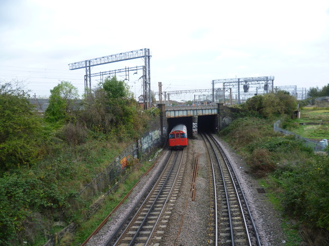
Image: © Marathon Taken: 22 Oct 2014
The London & Birmingham Railway opened from Euston to Boxmoor in 1837, and on to Birmingham in 1838. In 1846 it became part of the London & North Western Railway. Suburban services were diverted in 1912 to run over the "New Lines", which had just been built: these follow the route used today by Bakerloo line trains. The latter first operated over this section in 1917. Apart from the West Coast Main Line and the local line operated by London Overground and the Bakerloo line, there is a huge area of sidings extending for two miles, from Harlesden almost to Wembley Central. At their widest these are 350 metres across. Passengers on Bakerloo or London Overground trains at first follow the northern edge of the complex through Stonebridge Park station. Just before Wembley Central, the Bakerloo and Overground pass under the main line to emerge on its southern edge. This is the view from the long footbridge between Lyon Park Avenue and London Road, just to the south of Wembley Central station, looking in the direction of Stonebridge Park. A Bakerloo train heading towards Elephant & Castle is about to pass under the main lines and sidings. For the view looking in the other direction see http://www.geograph.org.uk/photo/4216433
Images are licensed for reuse under creativecommons.org/licenses/by-sa/2.0
Image Location
Latitude
51.547286
Longitude
-0.290131