The North Circular Road at Stonebridge
Introduction
The photograph on this page of The North Circular Road at Stonebridge by Marathon as part of the Geograph project.
The Geograph project started in 2005 with the aim of publishing, organising and preserving representative images for every square kilometre of Great Britain, Ireland and the Isle of Man.

There are currently over 7.5m images from over 14,400 individuals and you can help contribute to the project by visiting https://www.geograph.org.uk
The North Circular Road at Stonebridge
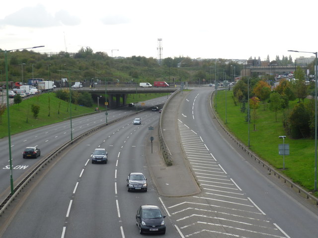
Image: © Marathon Taken: 22 Oct 2014
The area on the left was once part of Twyford Tip, also known as Abbey Road Mounds. Twyford Tip was a large irregular tip of waste material rising up to the south of the North Circular Road between Stonebridge and Hanger Lane. When the North Circular Road was widened in the 1990s,the mounds were re-moulded and landscaped. The nearer bridge over the North Circular Road carries Abbey Road while the one in the distance towards the right of the picture carries the Paddington Arm of the Grand Union Canal via an aqueduct.
Images are licensed for reuse under creativecommons.org/licenses/by-sa/2.0
Image Location


Leaflet Map data © OpenStreetMap
Latitude
51.540174
Longitude
-0.277275