Beech House
Introduction
The photograph on this page of Beech House by Jonathan Thacker as part of the Geograph project.
The Geograph project started in 2005 with the aim of publishing, organising and preserving representative images for every square kilometre of Great Britain, Ireland and the Isle of Man.

There are currently over 7.5m images from over 14,400 individuals and you can help contribute to the project by visiting https://www.geograph.org.uk
Beech House
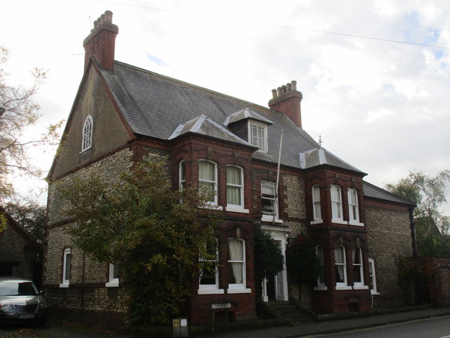
Image: © Jonathan Thacker Taken: 23 Oct 2014
An eighteenth century house extended in the late nineteenth century - the bay windows are from this time. http://www.britishlistedbuildings.co.uk/en-442597-beech-house-winterton-
Images are licensed for reuse under creativecommons.org/licenses/by-sa/2.0
Image Location
Latitude
53.653971
Longitude
-0.597976