Felling Metro station, Tyne & Wear
Introduction
The photograph on this page of Felling Metro station, Tyne & Wear by Nigel Thompson as part of the Geograph project.
The Geograph project started in 2005 with the aim of publishing, organising and preserving representative images for every square kilometre of Great Britain, Ireland and the Isle of Man.

There are currently over 7.5m images from over 14,400 individuals and you can help contribute to the project by visiting https://www.geograph.org.uk
Felling Metro station, Tyne & Wear
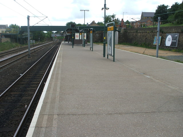
Image: © Nigel Thompson Taken: 7 Jun 2009
Originally opened in 1896 by the North Eastern railway on the line from Newcastle to Sunderland, this station replaced an earlier 1839 one sited just beyond the current station - see Image It was converted from heavy rail to Metro in 1981. View east towards Heworth and Sunderland. The platform was wider at one time and had a large canopy which extended over the tracks on either side. For further information, see http://disused-stations.org.uk/f/felling_second/index.shtml
Images are licensed for reuse under creativecommons.org/licenses/by-sa/2.0
Image Location
Latitude
54.952881
Longitude
-1.571366