Buston Manor Oast
Introduction
The photograph on this page of Buston Manor Oast by Marathon as part of the Geograph project.
The Geograph project started in 2005 with the aim of publishing, organising and preserving representative images for every square kilometre of Great Britain, Ireland and the Isle of Man.

There are currently over 7.5m images from over 14,400 individuals and you can help contribute to the project by visiting https://www.geograph.org.uk
Buston Manor Oast
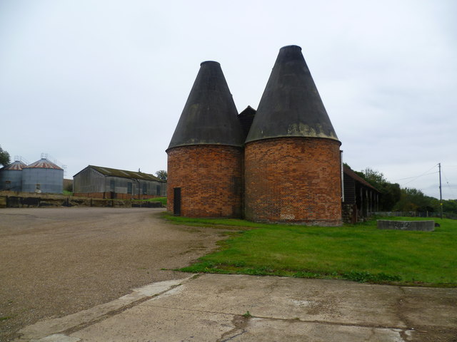
Image: © Marathon Taken: 12 Oct 2014
The Greensand Way is 108 miles long and runs from Haslemere in Surrey to Hamstreet in Kent. This is the section between Yalding and Linton which largely follows the scarp edge of the Greensand Ridge and provides superb views across the Weald. Here it passes through Buston Manor and its many outbuildings before rising up to the ridge. Buston Manor itself is medieval in origin. For a closer view and a little more detail see http://www.geograph.org.uk/photo/4204115 The oast houses were noted as being converted for housing in 2008 - see http://www.geograph.org.uk/photo/1024635 and in 2009 - see http://www.geograph.org.uk/photo/1143910 but do not look a whole lot different at the end of 2014.
Images are licensed for reuse under creativecommons.org/licenses/by-sa/2.0
Image Location
Latitude
51.230993
Longitude
0.454286