Boundary sign between Clarborough and Welham
Introduction
The photograph on this page of Boundary sign between Clarborough and Welham by Alan Murray-Rust as part of the Geograph project.
The Geograph project started in 2005 with the aim of publishing, organising and preserving representative images for every square kilometre of Great Britain, Ireland and the Isle of Man.

There are currently over 7.5m images from over 14,400 individuals and you can help contribute to the project by visiting https://www.geograph.org.uk
Boundary sign between Clarborough and Welham
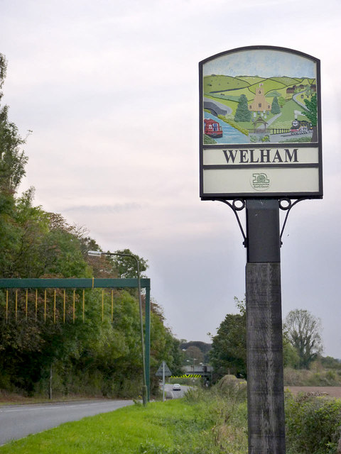
Image: © Alan Murray-Rust Taken: 5 Oct 2014
The sign displays the same picture on both sides, but with the different village names. It depicts the church, the Chesterfield Canal, and the railway line in general rural scenery. Traditionally Welham has been part of Clarborough parish which is recognised in the current civil parish name. See http://www.geograph.org.uk/photo/4199496 for the other side.
Images are licensed for reuse under creativecommons.org/licenses/by-sa/2.0
Image Location


Leaflet Map data © OpenStreetMap
Latitude
53.336634
Longitude
-0.90562