Port Carlisle
Introduction
The photograph on this page of Port Carlisle by Stephen McKay as part of the Geograph project.
The Geograph project started in 2005 with the aim of publishing, organising and preserving representative images for every square kilometre of Great Britain, Ireland and the Isle of Man.

There are currently over 7.5m images from over 14,400 individuals and you can help contribute to the project by visiting https://www.geograph.org.uk
Port Carlisle
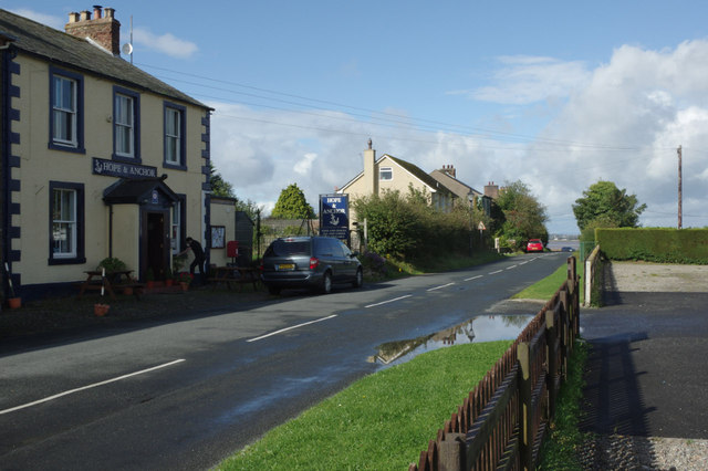
Image: © Stephen McKay Taken: 4 Oct 2014
There isn't much to Port Carlisle these days (although the village does have a pub - the Hope and Anchor) so it may come as a surprise that for a period in the 19th century there was a regular ferry service between here and Liverpool. The site was chosen for development because this was the highest point on the Solway Firth reachable by vessels up to 100 tons. There was a canal, and later a railway, connection to Carlisle. This activity did not last long, however, with trade transferred to other ports, including Maryport and Whitehaven, in the 1850s. The railway (whose terminus was behind where the photographer is standing) was operated by horses until 1914 and was finally abandoned in 1931.
Images are licensed for reuse under creativecommons.org/licenses/by-sa/2.0
Image Location
Latitude
54.948731
Longitude
-3.187628