Church of All Saints, Beckingham
Introduction
The photograph on this page of Church of All Saints, Beckingham by Alan Murray-Rust as part of the Geograph project.
The Geograph project started in 2005 with the aim of publishing, organising and preserving representative images for every square kilometre of Great Britain, Ireland and the Isle of Man.

There are currently over 7.5m images from over 14,400 individuals and you can help contribute to the project by visiting https://www.geograph.org.uk
Church of All Saints, Beckingham
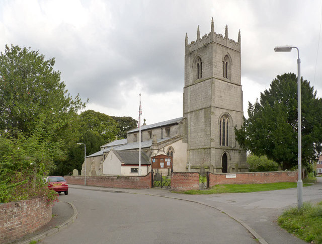
Image: © Alan Murray-Rust Taken: 28 Sep 2014
View from the north-west. The new toilet and kitchen block has not yet had time to mellow. There is a bench mark http://www.geograph.org.uk/photo/4191283 just to the right of the west door. The churchyard wall dates back to the late 18th century, restored 1900 http://www.geograph.org.uk/photo/4191288 . Listed Grade II for group value.
Images are licensed for reuse under creativecommons.org/licenses/by-sa/2.0
Image Location
Latitude
53.403693
Longitude
-0.829894