St Mary the Virgin, Chigwell
Introduction
The photograph on this page of St Mary the Virgin, Chigwell by Bikeboy as part of the Geograph project.
The Geograph project started in 2005 with the aim of publishing, organising and preserving representative images for every square kilometre of Great Britain, Ireland and the Isle of Man.

There are currently over 7.5m images from over 14,400 individuals and you can help contribute to the project by visiting https://www.geograph.org.uk
St Mary the Virgin, Chigwell
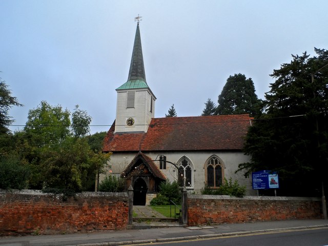
Image: © Bikeboy Taken: 13 Sep 2014
The part of the church visible from this side is the original C12 structure with C15 bell turret. The church was greatly extended in the C19 but most of this is out of view. See http://www.geograph.org.uk/photo/4190934for that part of the structure.
Images are licensed for reuse under creativecommons.org/licenses/by-sa/2.0
Image Location
Latitude
51.624217
Longitude
0.080154