Fernhead Road, W9
Introduction
The photograph on this page of Fernhead Road, W9 by Danny P Robinson as part of the Geograph project.
The Geograph project started in 2005 with the aim of publishing, organising and preserving representative images for every square kilometre of Great Britain, Ireland and the Isle of Man.

There are currently over 7.5m images from over 14,400 individuals and you can help contribute to the project by visiting https://www.geograph.org.uk
Fernhead Road, W9
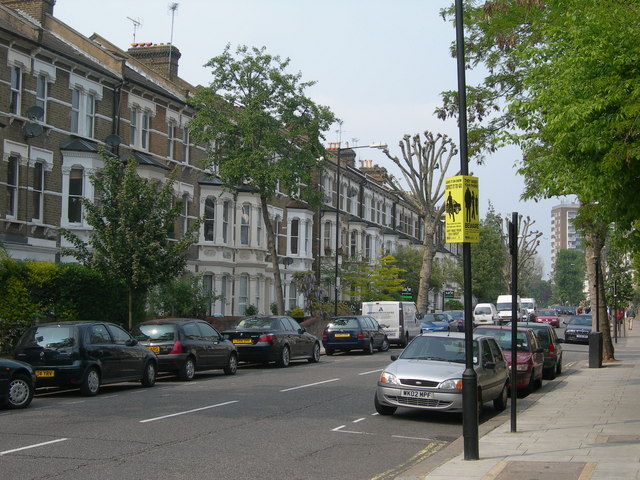
Image: © Danny P Robinson Taken: 29 Apr 2007
At the junction of Croxley Road, looking towards Queens Park. Tall 19th century houses like these are the predominant feature in this area. Many will now have been converted to flats. The yellow sign is a police warning not to display your valuables indiscreetly as there is a higher than average risk of muggings or thefts from vehicles here. MP3 players and high spec mobile phones are particularly vulnerable.
Images are licensed for reuse under creativecommons.org/licenses/by-sa/2.0
Image Location
Latitude
51.529427
Longitude
-0.20228