Memorial Hall
Introduction
The photograph on this page of Memorial Hall by Ian Capper as part of the Geograph project.
The Geograph project started in 2005 with the aim of publishing, organising and preserving representative images for every square kilometre of Great Britain, Ireland and the Isle of Man.

There are currently over 7.5m images from over 14,400 individuals and you can help contribute to the project by visiting https://www.geograph.org.uk
Memorial Hall
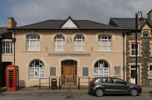
Image: © Ian Capper Taken: 6 Sep 2014
Built in 1875 as a market hall by Aberystwyth architect and builder Roderick Williams, funded by the Powell family of Nanteos, for whom he also worked as estate architect. Altered in 1922 when it was rebranded as the Memorial Hall, with plaques either side of the main door, one referring to the 1922 alteration and dedication (see Image), the other the Great War commemorations (see Image ). A further plaque was added on the right hand side of the facade following the Second World War (see Image). It underwent a full £100,000 renovation in 2011-12 funded by grants from the Welsh government, Ceredigion council and the European Union. For wider view, see Image
Images are licensed for reuse under creativecommons.org/licenses/by-sa/2.0
Image Location
Latitude
52.219631
Longitude
-3.932519