Crimea incline
Introduction
The photograph on this page of Crimea incline by Jonathan Wilkins as part of the Geograph project.
The Geograph project started in 2005 with the aim of publishing, organising and preserving representative images for every square kilometre of Great Britain, Ireland and the Isle of Man.

There are currently over 7.5m images from over 14,400 individuals and you can help contribute to the project by visiting https://www.geograph.org.uk
Crimea incline
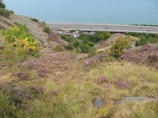
Image: © Jonathan Wilkins Taken: 24 Aug 2014
This pair of self-acting inclines was the route followed by all of the products from Brundrit's quarrying. In later years extensive storage hoppers were constructed above the Penmaen Jetty and conveyor belts replaced the tramways on the jetty, but it was always a boast that ships could be loaded with crushed rock on both sides of the jetty simultaneously. Close examination is required to find any evidence of this furious activity today, and the A55 Expressway runs over the site of the storage hoppers on a significant viaduct. Closure of Wright's rail sidings and jetty in 1952 meant the closure of these inclines as well - all traffic being routed via Bell Yard from this time.
Images are licensed for reuse under creativecommons.org/licenses/by-sa/2.0
Image Location
Latitude
53.265809
Longitude
-3.940561