Previously WW1 Drill hall, now residential
Introduction
The photograph on this page of Previously WW1 Drill hall, now residential by Phillip Williams as part of the Geograph project.
The Geograph project started in 2005 with the aim of publishing, organising and preserving representative images for every square kilometre of Great Britain, Ireland and the Isle of Man.

There are currently over 7.5m images from over 14,400 individuals and you can help contribute to the project by visiting https://www.geograph.org.uk
Previously WW1 Drill hall, now residential
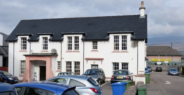
Image: © Phillip Williams Taken: 22 Sep 2014
World War One Audit of Surviving Remains, Osborne (2006), records a drill hall in Mary Street. The front block is two-storeyed with half dormers, with a single-storey hall behind. The building had not been built by the time of the 2nd edition OS 1:2500 map. The building has now been converted to housing. In 1914 the hall was the drill station for "A" Squadron, 1st Lovat's Scouts and base for "E" Company, 4th battalion Cameron Highlanders. Information from HS/RCAHMS World War One Audit Project (GJB) 19 July 2013. The single-storey hall is now a row of small houses.
Images are licensed for reuse under creativecommons.org/licenses/by-sa/2.0
Image Location
Latitude
56.820176
Longitude
-5.103843