Barrow Upon Trent, The Old School House
Introduction
The photograph on this page of Barrow Upon Trent, The Old School House by David Dixon as part of the Geograph project.
The Geograph project started in 2005 with the aim of publishing, organising and preserving representative images for every square kilometre of Great Britain, Ireland and the Isle of Man.

There are currently over 7.5m images from over 14,400 individuals and you can help contribute to the project by visiting https://www.geograph.org.uk
Barrow Upon Trent, The Old School House
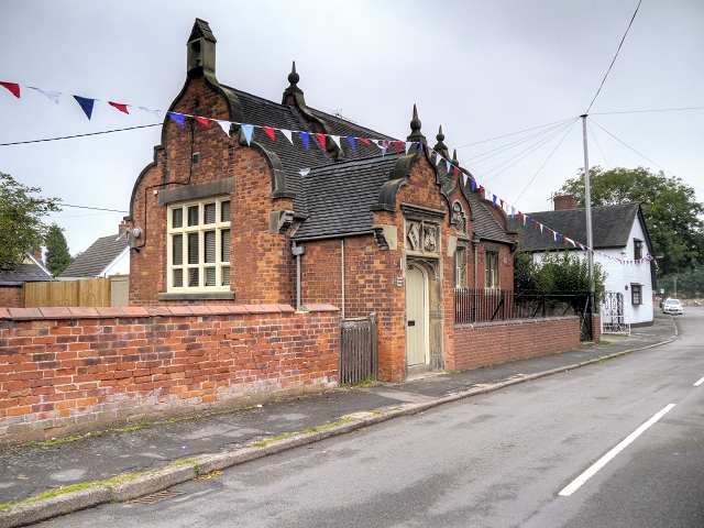
Image: © David Dixon Taken: 19 Sep 2014
The village school is a Grade II listed building (English Heritage Building ID: 82694 http://www.britishlistedbuildings.co.uk/en-82694-village-school-barrow-upon-trent-derbyshi British Listed Buildings). It was built by public subscription in 1843 in Jacobean style, using red brick with sandstone dressings, and run under the auspices of the National Schools Society. There is a later addition on the west side. A new school was opened in 1998, on the other side of the road.
Images are licensed for reuse under creativecommons.org/licenses/by-sa/2.0
Image Location
Latitude
52.8533
Longitude
-1.478272