Chancel of St Mary de Lode
Introduction
The photograph on this page of Chancel of St Mary de Lode by Philip Halling as part of the Geograph project.
The Geograph project started in 2005 with the aim of publishing, organising and preserving representative images for every square kilometre of Great Britain, Ireland and the Isle of Man.

There are currently over 7.5m images from over 14,400 individuals and you can help contribute to the project by visiting https://www.geograph.org.uk
Chancel of St Mary de Lode
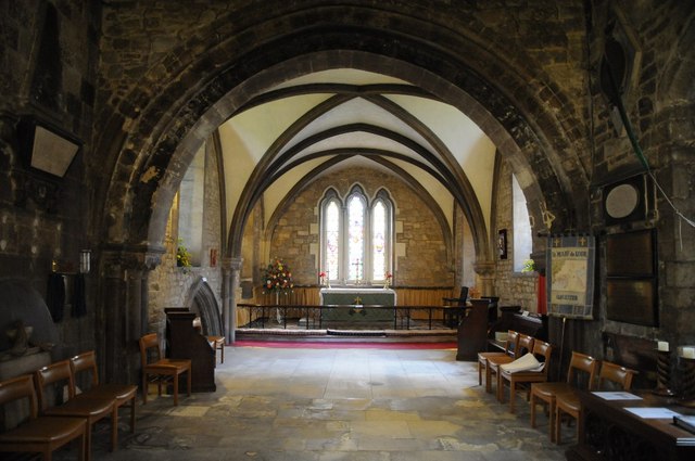
Image: © Philip Halling Taken: 13 Sep 2014
The Norman chancel of St Mary de Lode. The name, lode refers to the church's proximity to the River Severn, in the past the river was nearer than it is today. Lode refers to a crossing point on the river, the name appears in several locations on the Severn. During in the civil War the church was used by Parliamentarian forces to imprison Royalist soldiers in 1943 and 1646.
Images are licensed for reuse under creativecommons.org/licenses/by-sa/2.0
Image Location
Latitude
51.868412
Longitude
-2.249178