Paynesfield, Bolney
Introduction
The photograph on this page of Paynesfield, Bolney by Simon Carey as part of the Geograph project.
The Geograph project started in 2005 with the aim of publishing, organising and preserving representative images for every square kilometre of Great Britain, Ireland and the Isle of Man.

There are currently over 7.5m images from over 14,400 individuals and you can help contribute to the project by visiting https://www.geograph.org.uk
Paynesfield, Bolney
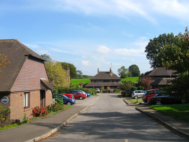
Image: © Simon Carey Taken: 19 Sep 2014
A small cul de sac built sometime in the 1990s and named after a local haulage company which operated out of the village for over 100 years. The houses on the left keep with the theme and are called Drovers. According to Bolney's 1842 tithe map this was once Upper Field and lies to the south of Image
Images are licensed for reuse under creativecommons.org/licenses/by-sa/2.0
Image Location
Latitude
50.992661
Longitude
-0.20315