Sellafield Visitor Centre
Introduction
The photograph on this page of Sellafield Visitor Centre by Trevor Littlewood as part of the Geograph project.
The Geograph project started in 2005 with the aim of publishing, organising and preserving representative images for every square kilometre of Great Britain, Ireland and the Isle of Man.

There are currently over 7.5m images from over 14,400 individuals and you can help contribute to the project by visiting https://www.geograph.org.uk
Sellafield Visitor Centre
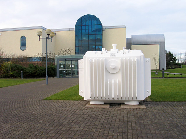
Image: © Trevor Littlewood Taken: 25 Jan 2005
Sellafield Visitor Centre was built adjacent to the nuclear power station, reprocessing site and all of the other facilities on the vast plant just north of Seascale. The facility was open to the public at the time the image was recorded (January 2005) but it seems now to be closed. The white structure standing in front of the main building is a nuclear fuel flask, used to transport spent fuel to Sellafield. (Thanks to Ian Taylor for identifying the vessel.)
Images are licensed for reuse under creativecommons.org/licenses/by-sa/2.0
Image Location
Latitude
54.433038
Longitude
-3.49549