Puttenham
Introduction
The photograph on this page of Puttenham by Colin Smith as part of the Geograph project.
The Geograph project started in 2005 with the aim of publishing, organising and preserving representative images for every square kilometre of Great Britain, Ireland and the Isle of Man.

There are currently over 7.5m images from over 14,400 individuals and you can help contribute to the project by visiting https://www.geograph.org.uk
Puttenham
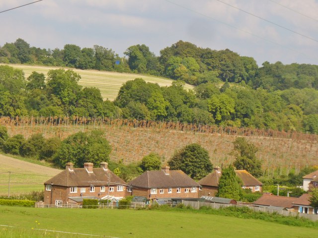
Image: © Colin Smith Taken: 12 Sep 2014
"Puttenham lies in the so-called Vale of Holmesdale between the chalky North Downs to the north and Greensand Ridge to the south". Puttenham Hop Garden is visible here - it supplies the nearby Hogs Back Brewery at Tongham. http://en.wikipedia.org/wiki/Puttenham,_Surrey
Images are licensed for reuse under creativecommons.org/licenses/by-sa/2.0
Image Location


Leaflet Map data © OpenStreetMap
Latitude
51.221663
Longitude
-0.678701