Duke of Northumberland's River alongside the Southern Perimeter Road
Introduction
The photograph on this page of Duke of Northumberland's River alongside the Southern Perimeter Road by Marathon as part of the Geograph project.
The Geograph project started in 2005 with the aim of publishing, organising and preserving representative images for every square kilometre of Great Britain, Ireland and the Isle of Man.

There are currently over 7.5m images from over 14,400 individuals and you can help contribute to the project by visiting https://www.geograph.org.uk
Duke of Northumberland's River alongside the Southern Perimeter Road
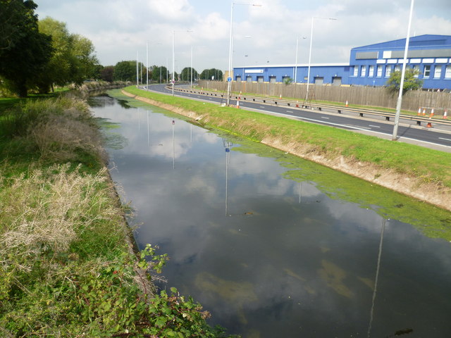
Image: © Marathon Taken: 10 Sep 2014
Ahead is The Duke of Northumberland's River and out of sight beyond the trees on the left is the Longford River. To the south of Heathrow Airport and its Southern Perimeter Road, the two waterways run parallel and it is possible to follow a track between them. Here they are known as the Twin Rivers. This western section of the Duke of Northumberland's River was constructed during the reign of King Henry VIIIth. It takes water from the River Colne and was designed to supplement the flow to existing mills. Charles I ordered the construction of the totally artificial watercourse known as the Longford River to carry water from the River Colne to the water features in Bushy Park and then on to the Long Water in Home Park at Hampton Court. The Longford River opened in 1638.
Images are licensed for reuse under creativecommons.org/licenses/by-sa/2.0
Image Location
Latitude
51.458532
Longitude
-0.472516