Old Pike House, Station Road, Purton
Introduction
The photograph on this page of Old Pike House, Station Road, Purton by Brian Robert Marshall as part of the Geograph project.
The Geograph project started in 2005 with the aim of publishing, organising and preserving representative images for every square kilometre of Great Britain, Ireland and the Isle of Man.

There are currently over 7.5m images from over 14,400 individuals and you can help contribute to the project by visiting https://www.geograph.org.uk
Old Pike House, Station Road, Purton
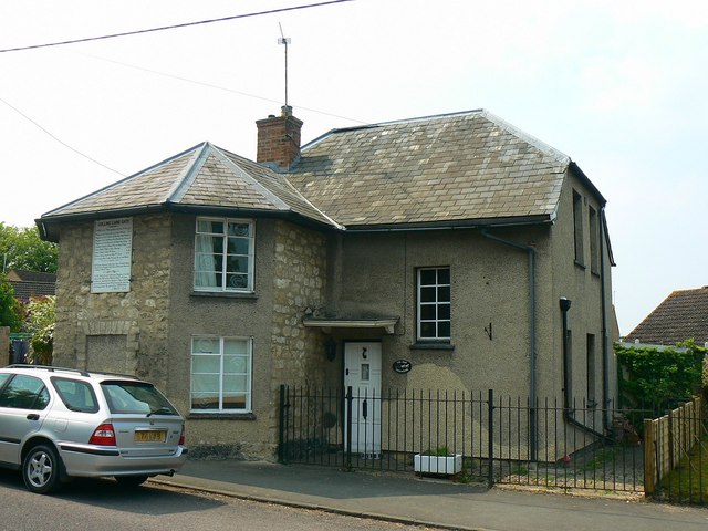
Image: © Brian Robert Marshall Taken: 28 Apr 2007
The property was a toll-house and has the typical front extension to afford views up and down the turnpike for travellers. Visible on the front of the extension is a board providing information on prices. Image Although the building is early 19th century, the turnpike it served, the Swindon, Calne and Cricklade Roads, were turnpiked from 1790 until 1879. The original name of the gatehouse was Collins Lane Gate and there would have been a gate or other barrier across the road. The tolls payable went towards maintaining the road. Thanks to Trish Steel for the additional information.
Images are licensed for reuse under creativecommons.org/licenses/by-sa/2.0
Image Location
Latitude
51.589516
Longitude
-1.866289