Redwoods, Crossways, Bolney
Introduction
The photograph on this page of Redwoods, Crossways, Bolney by Simon Carey as part of the Geograph project.
The Geograph project started in 2005 with the aim of publishing, organising and preserving representative images for every square kilometre of Great Britain, Ireland and the Isle of Man.

There are currently over 7.5m images from over 14,400 individuals and you can help contribute to the project by visiting https://www.geograph.org.uk
Redwoods, Crossways, Bolney
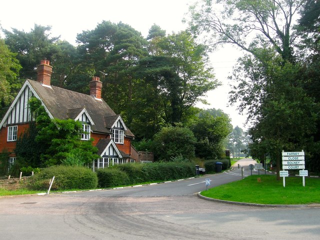
Image: © Simon Carey Taken: 7 Sep 2014
Built as a substantial Edwardian lodge for Gravenhurst, a large 19th century house first renamed Bolney Court, which was later converted into a school, Farney Close, in the early 1960s. The former lodge was given its current name sometime after, appearing as it on the 1974 OS map.
Images are licensed for reuse under creativecommons.org/licenses/by-sa/2.0
Image Location
Latitude
50.987792
Longitude
-0.196498